Our Services
The DMP Service Approach
-
Be an extension of our client's staff
-
Communicate effectively so needs and desires are defined throughout the planning process and carried out through design
-
Organize a team of specialists when necessary to provide the required range of engineering services to meet our client's needs
-
Focus on quality and coordination to complete your individual projects in a timely manner
DMP Engineering Services
Planning
-
Land planning and development
-
Municipal Boundary Adjustments
-
Project Planning, preliminary engineering reports
-
Grantsmanship & funding assistance
-
Utility layers & Databased for GIS application
Hydrology
-
Stormwater management and treatment
-
Water quality enhancement
-
Flood modeling and routing
-
Bio-cells and constructed wetlands
-
FEMA map revisions
Educational Facilities
-
Utility layers & databases for GIS applications
-
Preliminary site selection and evaluation studies
-
Site development plans
-
Access road, parking, and traffic planning
-
Recreational fields and equipment
Transportation
-
Street and road improvements
-
Roadway-utility conflict resolution
-
Annual paving contracts
-
Roadway and hydraulics design
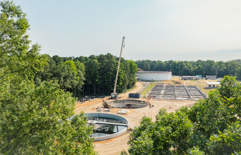
Water & Wastewater Facilities
-
Water distribution & wastewater collection
-
Pumping facilities
-
Treatment and storage facilities
-
Instrumentation, control, SCADA
Construction Management
-
Resident construction observation & inspection
-
Construction contract administration
-
Funding agency compliance
-
Davis-Bacon compliance reviews

Geomatics
Surveying has evolved throughout history from the Egyptian rope pullers at our beginning to modern 3D laser scanning using aerial drones. As our profession continues to change, the terminology of our profession is changing as well. Land Surveying is commonly referred to now as “Geomatics”, which is the branch of science that deals with the collection, analysis, and interpretation of data relating to the earth’s surface.
DMP’s Geomatics department is one of the cornerstones of our business, and one of the Triad’s largest surveying operations.
Our professional surveyors are licensed in multiple states, DMP field crews are well equipped with the latest technology including global positioning receivers (GPS), robotic operating stations, and other advanced technologies. This equipment helps ensure a fast and accurate product for our customers.
Our Geomatics department produces a wide variety of surveys for engineering projects, private developers, contractors, NCDOT, and public utility companies.
DMP Geomatics services include:
-
Subsurface Utility Engineering (SUE)
-
LiDAR Acquistion/Unmanned Aerial System (UAS)
-
3D Mapping
-
Hydrography
-
Construction Staking
-
Construction Surveys
-
GPS & Control Surveys
-
Boundary Surveys


Construction Administration
At DMP, our experienced team is dedicated to ensuring your project runs smoothly from start to finish, providing expert oversight and management every step of the way.
With a focus on quality assurance, adherence to timelines, and budget management, we offer comprehensive services that cover everything from contract negotiation and permit acquisition to site inspections and final project delivery. Our team leverages the latest technologies and industry best practices to mitigate risks and drive successful project outcomes. DMP’s construction administration department coordinates with our engineering teams as well as any engineering firm on the project, while resolving unforeseen issues that develop during construction.