Geomatics
Surveying continues its technological evolution, from the early techniques employed by ancient Egyptian rope pullers to the cutting-edge 3D laser scanning using aerial drones seen today. As our profession advances, the terminology also evolves; what was once simply known as land surveying is now often referred to as “Geomatics.” This branch of science focuses on the collection, analysis, and interpretation of data related to the earth’s surface.
DMP’s Geomatics Department stands as one of the cornerstones of our business and is among the largest surveying operations in the Triad. Our team of professional surveyors, licensed in multiple states, is supported by well-trained technicians utilizing the latest technology, including global positioning receivers (GPS), robotic total stations, unmanned aerial systems (UAS) with LiDAR collection capability and innovative software. This state-of-the-art technology ensures that we deliver timely and accurate results for our clients.
DMP’s Geomatics Services
-
Subsurface Utility Engineering (SUE)
-
LiDAR Acquistion/Unmanned Aerial System (UAS)
-
3D Mapping
-
Hydrography
-
Construction Staking
-
Construction Surveys
-
GPS & Control Surveys
-
Boundary Surveys

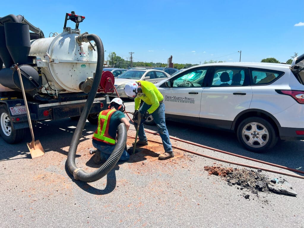
Subsurface Utility Engineering (SUE)
DMP’s SUE Department utilizes Electromagnetic (EM) and Ground Penetrating Radar (GPR) technology to assist clients with utility investigations.
For every $1 spent on SUE, nearly $5 in construction costs are saved.*
Any public works project or construction project where subsurface utilities may be encountered can benefit from Subsurface Utility Engineering (SUE). Developers, owners, designers, engineers, and contractors benefit from Identifying the location of subsurface utilities prior to beginning major excavations and can lead to significant cost savings by avoiding damage to existing utilities. SUE ensures that disturbances to existing utility customers are avoided or kept to a minimum. The table below lists the general categories of SUE activities that DMP has the equipment and expertise to perform.

Level A

Level B

Data Management

Conflict Analysis
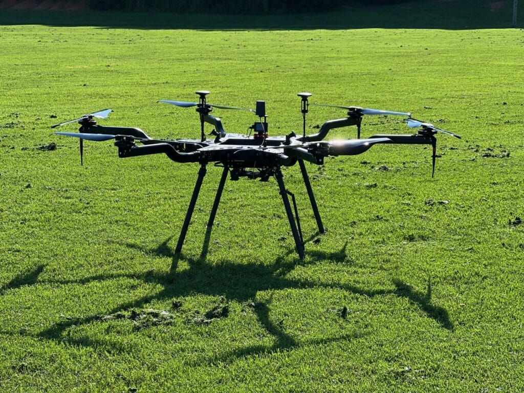
Remote Sensing/Unmanned Aerial System (UAS)
DMP’s Remote Sensing program has the dedicated staff, technology, and versatility to handle heavy workloads and large-scale projects that would not be practical for the traditional survey crew.
DMP offers Laser scanning using the Trimble SX10 platform on projects with criteria such as: minimal interruption of activities or traffic; inaccessible or unsafe areas; need for complex details; or the desire for complete 3D modeling for design in Revit or BIM software. 3D Scanning is the industry standard for detailed measurements in complex environments allowing for safe acquisition of reliable data.
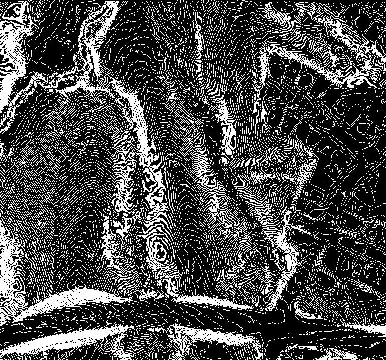
DMP’s UAS program began in 2020 and includes a Riegl aerial platform. Riegl LiDAR (light detection and ranging) allows us to efficiently gather accurate and reliable data which increases productivity on all projects, no matter the size, vegetation, or terrain. A 24-megapixel camera provides high quality aerial photography which, if needed, allows our clients to get to-date photos of sites showing existing conditions or visual updates on project progress.